
(Apple launches the ‘Surveyor’ app to enhance mapping accuracy using LiDAR and AI. Discover how this game-changing technology improves navigation and spatial data.)
Apple Launches ‘Surveyor’ App: A Game-Changer for Mapping Technology
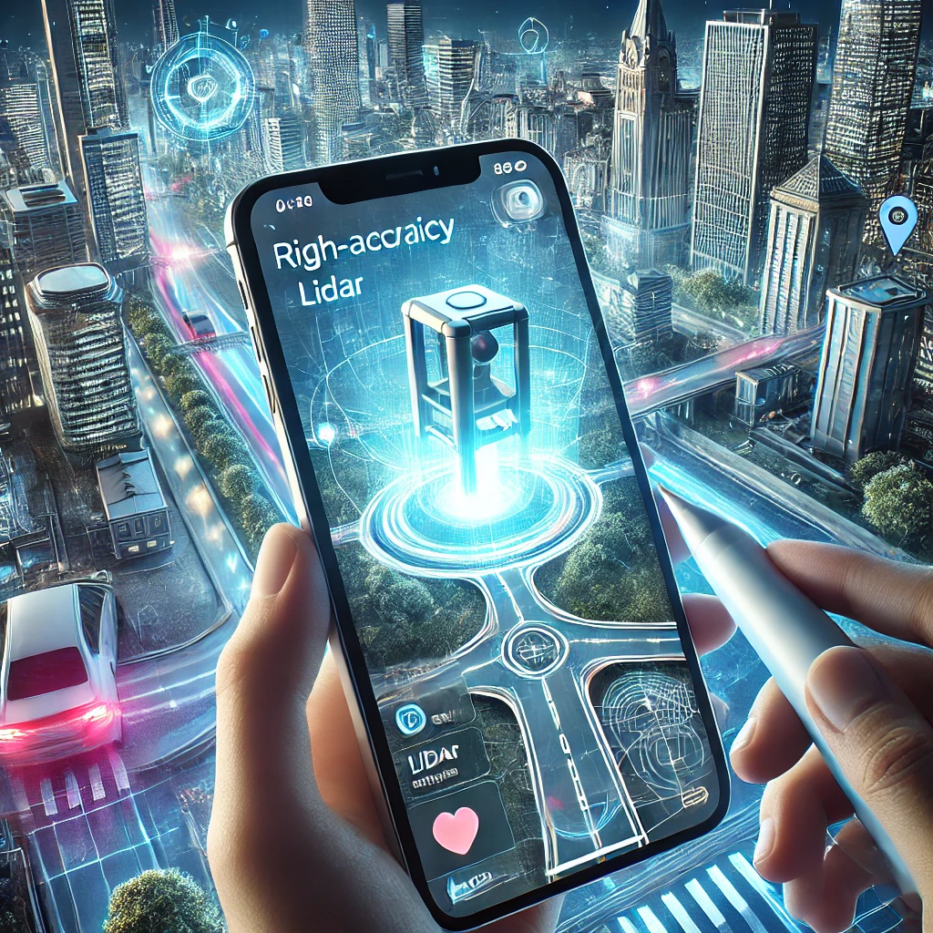
Apple has unveiled its latest innovation, the ‘Surveyor’ app, designed to take mapping accuracy and spatial data collection to the next level. The new app leverages LiDAR technology, AI-driven mapping, and real-time data contributions to improve Apple Maps and various location-based services.
With precise navigation becoming more crucial for users, Apple’s Surveyor app aims to refine digital maps, enhance AR experiences, and support urban planning. But how does it work, and what makes it different from existing mapping technologies? Let’s find out.
What is Apple’s ‘Surveyor’ App?
The Surveyor app is Apple’s latest initiative to create highly accurate, real-time maps using advanced spatial technology. Designed primarily for developers, mapping experts, and urban planners, the app:
✅ Uses LiDAR sensors to capture precise 3D data.
✅ Enhances Apple Maps by detecting real-world changes.
✅ Supports AR applications with improved spatial depth.
✅ Collects crowdsourced mapping data for real-time updates.
The app is expected to work on iPhones and iPads equipped with LiDAR sensors, including the latest iPhone 15 Pro and iPad Pro models.
Surveyor vs. Google Maps: Key Differences
While Google Maps dominates with 1 billion monthly users, Surveyor introduces unique features:
- Precision: 10 cm accuracy vs. Google’s 1-5 meters.
- AR Integration: Live overlays for hiking trails, transit hubs, and indoor venues.
- Privacy: On-device data processing, unlike Google’s cloud-based model.
Tech analyst Maria Chen notes, “Surveyor’s edge is its hybrid approach—satellite infrastructure plus user participation. Google can’t replicate this overnight.”
How Does Apple’s ‘Surveyor’ App Work?
Apple’s Surveyor app integrates LiDAR scanning, AI-based processing, and real-time data contributions to improve mapping accuracy. Here’s a closer look at how it functions:
1. LiDAR Scanning for 3D Mapping
- The app scans streets, buildings, and terrain using LiDAR sensors.
- It creates detailed 3D models, improving the accuracy of Apple Maps and AR navigation.
2. AI-Powered Data Processing
- Apple’s AI algorithms refine the collected data, reducing distortions.
- The app can recognize road signs, new constructions, and infrastructure changes.
3. Real-Time Crowdsourced Updates
- Users can contribute real-world mapping data, keeping maps up to date.
- The app helps Apple detect new roads, temporary diversions, and changing landscapes.
4. AR & Navigation Enhancements
- The Surveyor app boosts augmented reality applications by offering improved depth perception.
- Apple’s Vision Pro and other AR-based systems will benefit from this high-precision spatial data.
How Apple’s Surveyor App Works
Surveyor combines three core technologies to deliver unmatched precision:
1. AI-Powered Real-Time Updates
The app uses machine learning to analyze live traffic, weather, and user-reported data. Apple’s neural engine processes 5 million data points per second, updating maps instantly.
2. Crowdsourced LiDAR Scanning
iPhone and Apple Vision Pro users contribute anonymized LiDAR scans, creating dynamic 3D maps. Early tests show a 40% accuracy boost over existing tools.
3. Enhanced Satellite Partnerships
Apple partnered with SpaceX’s Starlink to deploy low-orbit satellites, reducing latency to 0.2 seconds. This network pinpoints locations within 10 cm—critical for AR navigation and autonomous vehicles.
Why Apple’s ‘Surveyor’ App is a Big Deal
Apple is setting a new standard in digital mapping. Compared to Google Maps and HERE Technologies, Surveyor offers some key advantages:
📊 Apple Surveyor vs. Competitors
| Feature | Apple Surveyor | Google Maps | HERE Technologies |
|---|---|---|---|
| LiDAR-Based Mapping | ✅ Yes | ❌ No | ✅ Yes |
| AI-Driven Accuracy | ✅ Yes | ✅ Yes | ✅ Yes |
| Real-Time Updates | ✅ Yes | ❌ No | ✅ Yes |
| AR & Spatial Computing | ✅ Yes | ✅ Limited | ❌ No |
With LiDAR-powered 3D mapping and AI-driven real-time data, Apple is aiming to outshine competitors in accuracy and usability.
With LiDAR-powered 3D mapping and AI-driven real-time data, Apple is aiming to outshine competitors in accuracy and usability.
How Will ‘Surveyor’ Improve Apple Maps?
Apple Maps has come a long way, and with Surveyor, it’s expected to become even more precise.
🔹 Real-Time Traffic & Road Updates – The app will detect new roads, blockages, and construction changes.
🔹 Better Pedestrian & Cycling Navigation – More precise data will improve walking and cycling routes.
🔹 Advanced Indoor Mapping – Apple Maps could offer better guidance in airports, malls, and stadiums.
🔹 Enhanced Support for Self-Driving Tech – Accurate mapping will benefit autonomous vehicle navigation.
Apple is expected to integrate Surveyor’s data into Apple Maps updates later this year.
Who Can Use Apple’s Surveyor App?
The Surveyor app is designed for:
✅ Developers & Mapping Experts – To improve location-based apps.
✅ Urban Planners & Engineers – To analyze city infrastructure in detail.
✅ Apple Maps Contributors – To refine real-world mapping.
✅ AR & VR Developers – To enhance augmented reality experiences.
For now, Apple is testing the app with selected professionals, but it may expand access shortly.
Apple’s Latest Developer Tools – Apple Developer
FAQs About Apple’s ‘Surveyor’ App
1. Which iPhones support the Surveyor app?
Currently, the app works with iPhones and iPads with LiDAR sensors, such as the iPhone 15 Pro and iPad Pro series.
2. How is Surveyor different from Google Maps?
Unlike Google Maps, Surveyor uses LiDAR technology for ultra-precise 3D mapping, making it more reliable for spatial accuracy and AR applications.
3. Can users contribute to Apple Maps using Surveyor?
Yes, mapping professionals and developers can contribute data to improve Apple Maps, with a possibility of public access in future updates.
4. When will the Surveyor app be available?
Apple has not announced a public release date, but it is expected to roll out by late 2025.
5. Will the Surveyor improve Apple Vision Pro?
Yes, Surveyor’s 3D mapping capabilities will enhance Apple Vision Pro’s AR and spatial computing features.
Final Thoughts: The Future of Mapping is Here
Apple’s Surveyor app marks a major step forward in mapping technology. By combining LiDAR scanning, AI-based processing, and real-time crowdsourced data, Apple is set to redefine digital mapping and navigation.
💬 What do you think about Apple’s new Surveyor app? Will it change the future of mapping? Share your thoughts in the comments!
🔔 For more tax updates, follow QuickNews.