ISRO: 🛰️ 10 Satellites Bolstering India’s Security: Insights from ISRO Chief (shocking)
ISRO’s chief highlights 10 satellites operating continuously to safeguard India’s borders, emphasizing the nation’s commitment to space-based security.

In a significant development, the Indian Space Research Organisation (ISRO) has revealed that 10 dedicated satellites are actively monitoring India’s borders, providing real-time intelligence and enhancing national security. This announcement underscores India’s strategic focus on leveraging space technology for defense purposes.
🔍 ISRO’s Strategic Satellite Deployment
🛰️ Current Operational Satellites
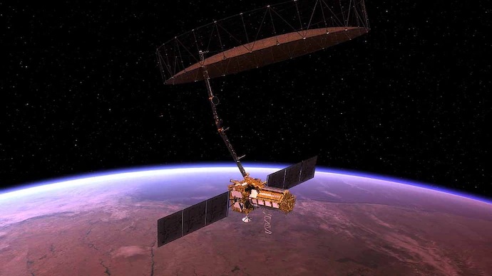
ISRO’s fleet includes satellites like RISAT, Cartosat, and EMISAT, each serving specific surveillance and reconnaissance roles:
- RISAT Series: Utilizes synthetic aperture radar to provide all-weather, day-and-night imaging capabilities.
- Cartosat Series: Offers high-resolution optical imagery, crucial for cartographic applications and border monitoring.Wikipedia+2DDE+2Wikipedia+2
- EMISAT: Designed for electronic intelligence, aiding in signal interception and analysis.
🚀 Future Endeavors
ISRO plans to launch 50 AI-based surveillance satellites over the next five years. These satellites will feature advanced technologies, including:
- Artificial Intelligence: Enabling autonomous data processing and decision-making.
- Inter-Satellite Communication: Facilitating coordinated operations and data sharing.
- Multi-Orbit Deployment: Ensuring comprehensive coverage from various orbital positions.

📊 Enhancing National Security Through Space
The integration of these satellites into India’s defense infrastructure offers several advantages:
- Real-Time Surveillance: Continuous monitoring of borders and sensitive regions.
- Disaster Management: Rapid assessment and response to natural calamities. EO Portal
- Maritime Security: Tracking naval movements and safeguarding maritime interests.
🌐 International Significance of India’s Satellite Network
India’s growing space surveillance network is not only valuable for national defense but also plays a critical role in regional stability. With neighbors like China and Pakistan maintaining active military postures, India’s real-time monitoring from space offers a strategic edge. These satellites act as early warning systems, detecting enemy movements, missile tests, or potential threats in disputed areas such as Ladakh, Arunachal Pradesh, or the Line of Control (LoC).
Moreover, this satellite data is also shared selectively with friendly nations, showcasing India as a responsible space power. As per ISRO officials, cooperation with countries like France and the United States has led to better satellite imagery exchange, disaster response coordination, and joint space research.
🛰️ How ISRO Integrates with Indian Armed Forces
India’s Defence Space Agency (DSA), set up in 2019, works closely with ISRO to convert satellite data into actionable intelligence for the Indian Army, Navy, and Air Force. These real-time images and sensor-based signals help armed forces track infiltration, monitor terrain changes, and plan critical operations.
Additionally, many satellites also support encrypted communication channels for secure transmission of military data, especially important during war-like situations or terrorist operations.
Some satellites like GSAT-7A and GSAT-6A serve directly as military communication satellites, ensuring that India’s command centers remain connected with frontline soldiers even in remote or conflict-ridden areas.
🧠 R&D and AI-Powered Surveillance
ISRO’s upcoming satellite missions will include deep learning algorithms that can auto-detect unusual movements, such as troop build-ups, illegal constructions, or sudden terrain shifts. This drastically reduces response time and human error.
In the words of ISRO chief S. Somanath, “We are entering an era where AI will become the second pair of eyes for every Indian satellite. Our skies are not just watched — they’re understood.”
🔗 Related Developments
India’s collaboration with private entities, such as Skyroot Aerospace and Agnikul Cosmos, is propelling the nation’s space capabilities. These partnerships aim to enhance satellite deployment efficiency and innovation.
❓ FAQs on ISRO’s Surveillance Satellites
Q1: What is the primary purpose of these satellites?
A1: They are designed for continuous monitoring of India’s borders, aiding in national security and disaster management.
Q2: How does AI enhance satellite functionality?
A2: AI enables autonomous data analysis, reducing the need for ground-based processing and allowing quicker decision-making.
Q3: What is the significance of multi-orbit deployment?
A3: Deploying satellites in various orbits ensures comprehensive coverage and redundancy, enhancing reliability.
Read also – https://quicknews.press/yes-bank-jump-9-as-smbc-invests-%e2%82%b913483-cr-20-stake/
Learn more about India’s space strategy and private sector collaborations in our article on India’s Space Strategy: Harnessing Data and Tiny Satellites.
📢 Conclusion
ISRO’s commitment to deploying advanced surveillance satellites marks a pivotal step in strengthening India’s defense and disaster management capabilities. As technology evolves, these space-based assets will play an increasingly vital role in safeguarding the nation’s interests.


